

Stage 2. Co-design and deployment
What it's for. Monitoring is designed together: knowledge of the territory, scientific rigor and technical capabilities define what is measured, where and how. The quality of everything that follows depends on that design and on an orderly record of every piece of equipment installed.
 How do we design monitoring with the territory and collect reliable data?By the end you will have: An agreed monitoring design and equipment installed and logged
What we did in Dzilam
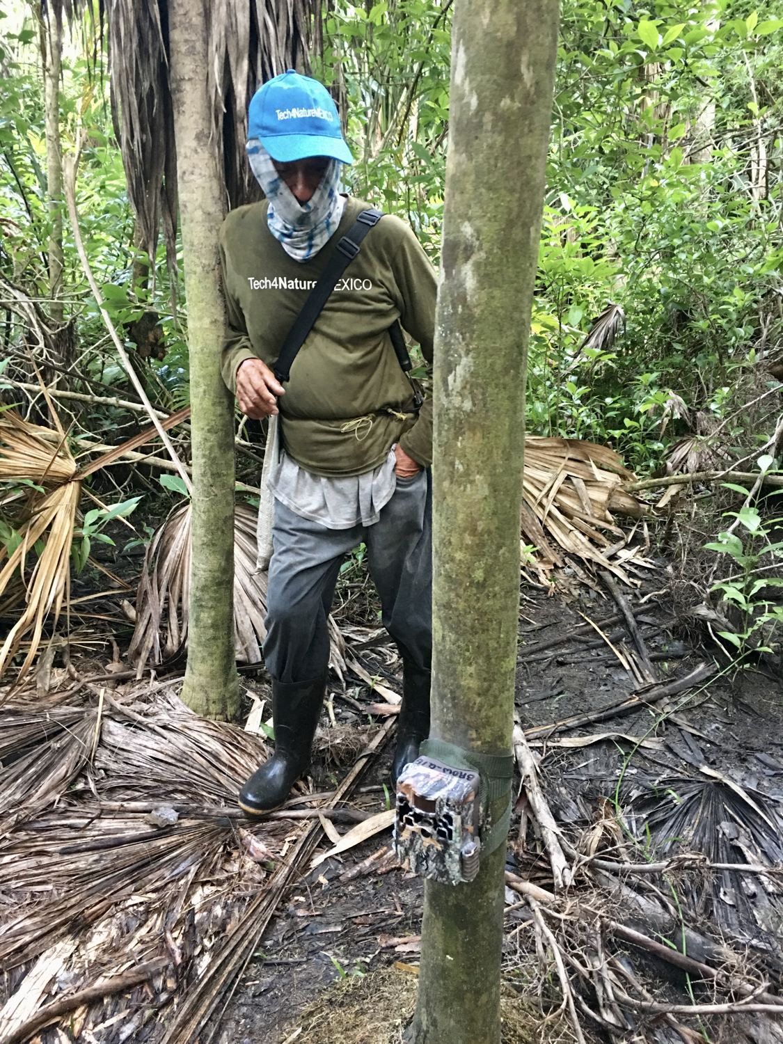
Community leaders from the Chac Mool Group, the SDS and C Minds chose the monitoring sites together: the community monitors knew where the jaguar crossed and where equipment could withstand flooding. In phase 1, camera traps and 60 acoustic recorders were installed in mangroves and low forest, and the Chac Mool Group handled installation, maintenance and data downloads. Combining image and sound broadened the wildlife groups recorded: cameras capture medium and large mammals, while recorders pick up birds, amphibians and insects. In phase 2, digital forms were tested to log field activities.
What is a camera trap?
A camera trap is a weatherproof camera strapped to a tree or post that triggers on its own when it detects an animal's heat and movement. It takes photos or videos by day and, with infrared light, by night too, with no one present. That is how it records animals that are rarely seen.
- Sensor
- Detects the heat difference of a moving animal and triggers the camera in under a second.
- Photos and video
- Saves bursts of photos or short videos with date and time. At night it uses infrared light that animals barely notice.
- Autonomy
- With batteries and a memory card it can run for weeks or months. The team visits to change batteries and download the files.
Use it when you want to…
- Learning which medium and large mammals and ground-dwelling birds live in a place.
- Documenting species that are hard to see, nocturnal or scarce, such as the jaguar, the ocelot or the white-lipped peccary.
- Identifying individuals with unique markings, such as jaguar rosettes.
- Comparing sites and seasons with the same sampling effort.
- Recording wildlife crossings, watering holes and encounters with cattle or hunting.
Combine it with other tools to…
- Small birds, frogs and insects: these are better recorded with acoustic recorders.
- Exact counts of animals without individual markings.
- Busy sites or places at risk of theft, unless there is a lock and a community agreement.
- Areas with no one able to visit them regularly.
What about an acoustic recorder?
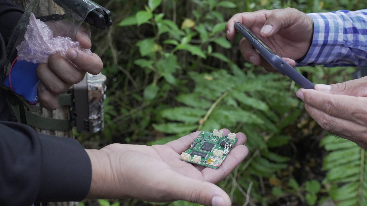
An autonomous acoustic recorder such as AudioMoth straps to a tree and records the soundscape on a schedule. It captures what a camera cannot see: birds, amphibians, bats and insects. It is open, low-cost and fits in the palm of your hand.
- Manual de configuración e instalación de AudioMoth 1.2.0 (in Spanish, 2026) (opens in a new tab)
- AudioMoth Operation Manual (Open Acoustic Devices) (opens in a new tab)
- Configuring your AudioMoth for Arbimon (Rainforest Connection) (opens in a new tab)
- Getting started with Arbimon, to analyze the recordings (opens in a new tab)
Key steps
Hold a co-design workshop with the community team, the authority and people trained in ecology: species of interest, sites, visit schedule, roles and field budget.
Choose the method according to the goal: camera traps for medium and large mammals and for jaguars; acoustic recorders such as AudioMoth for birds, amphibians, bats and insects; both for a broad inventory.
Place stations with people who know the trails, wildlife crossings, waterholes and hunting areas, and combine them with a systematic design that allows sites to be compared. Record that knowledge in template 5. P5
To identify individual jaguars, install cameras in pairs, facing each other, to photograph both flanks of the animal.
Log each camera with the same fields BioScanner requires, ideally in a KoboToolbox form on a phone with good GPS. Use template 3. P3
Store the original files in one folder per camera and per visit, and make a backup copy before processing.
Lesson learned
Local knowledge about where wildlife moves was as valuable as the equipment. When the community team takes part in the design, it also takes charge of maintenance, and monitoring continues between field campaigns.
Tools to get started
- Manual de fototrampeo para estudio de fauna silvestre: el jaguar en México como estudio de caso (opens in a new tab) (Chávez et al., 2013, in Spanish).
- Manual de fototrampeo: herramienta de investigación para la conservación de la biodiversidad en Colombia (opens in a new tab) (Instituto Humboldt and Panthera, 2012, in Spanish).
- BIOCOMUNI v2.0 Fauna (opens in a new tab) (FMCN and CONAFOR, in Spanish), a community monitoring protocol with printable forms.
- Introducción al monitoreo ambiental comunitario (opens in a new tab) (Forest Peoples Programme, in Spanish): designing monitoring with the community.
- Buenas prácticas para gestionar y publicar datos de cámaras trampa (opens in a new tab) (GBIF, 2026, in Spanish).
- KoboToolbox (opens in a new tab), free field forms that work offline and record location with the phone's GPS.
- SMART (opens in a new tab), a free tool to log patrols and observations in protected areas.
Criteria 2.1, 2.3 and 2.4 (design and planning). The species inventory, the threat log and local knowledge about land use show that the area identifies and understands its values, threats and social context. See how to prepare for the Green List.
Alto Isoso, Bolivia
Ten Guaraní community park rangers monitor the Chaco guanaco in the Guajukaka Habitat Area (284,670 ha), in the Guaraní Indigenous Autonomy of Charagua Iyambae. They use SMART offline, camera traps and fecal samples for DNA analysis. It was the first site in Bolivia to implement SMART, and Fundación Natura Bolivia is extending the model to 24 subnational protected areas. Operations cost about 2,500 dollars a month, a useful figure for budget planning.